Trail Projects

What It Takes to Build A Trail

From the first time someone thinks, “Hey, this is a great spot for a trail,” to its construction, almost all public, multipurpose trails go through these phases on their road to completion. Not all phases run congruent to each other and many times phases are happening at the same time. 


Resource Development


(2-5 years): Figuring out whether there are enough cash resources, partners, and public desire for a proposed stretch of trail. How much does it cost? Each mile of trail averages between $800,000-$1.2 million.

Pre-Engineering/ Study


(3-6 months): Let’s take a serious look at this proposed section, and determine whether there will be any obstacles. Is there a wetland, or a creek? Which side of the road will have the greatest benefit, and least impact? What is the grade? Are there resources like mature trees we’d like to work around? The partners in the project visit the site several times with engineering experts, to determine how best to create the new trail.

Engineering & Design


(6-12 months): Once the Pre-engineering decisions are made, experienced engineers will survey and create the construction plans or “blueprints” for the actual project, taking into consideration all of the questions addressed above.


Bidding


(3-6 months): Projects that are being completed by municipalities and/or using public resources from local, state, and federal sources must follow statutes regarding open bidding for these projects.

Right-Of-Way Acquisition


(1-2 years): With a final plan and the funds in place, the partners can approach property owners to acquire the needed permission to proceed with the project. This includes the purchasing of right-of-way or donation by property owner, the granting of easements, and so forth.

Trail Construction


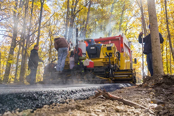
 (6-9 months): The construction phase includes relocating utilities as needed and installing the trail. Building a trail requires the same preliminary work as building a road.

Restoration Work


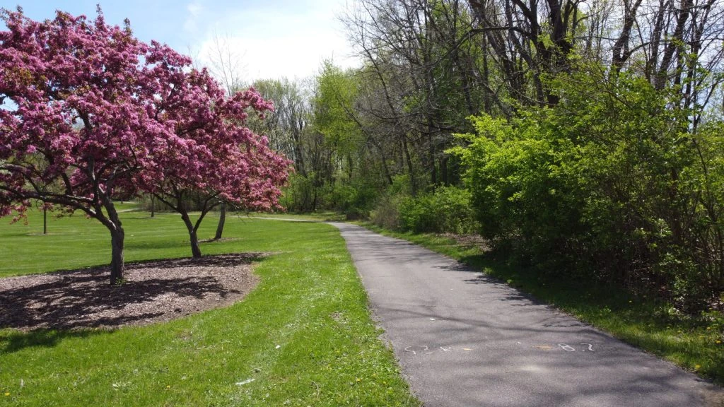
 (3-6 months): Once the trail construction is completed, the entire project gets a face lift, with fresh grass seedings, landscaping and trees as called for in the specific project, benches, signage, etc.

Current Fort Wayne Trails Assisted Projects

Other Trail Projects In Our Community

Recently Completed Trail Projects

Cedar Creek Parks Trail - Amstutz Road (.7mi)

Project Status


Completed Phases:            

Current Phase: Engineering and Right-of-Way Acquisition

Project Owner: Leo-Cedarville, Allen County, and Fort Wayne Trails Inc

Description: A 10′ wide trail on the east side of Amstutz Rd. will extend from Trading Post Rd. to Hosler Rd. This connects to the Leo Schools’ campuses. The northern section of this trail is a federally-funded project along with the widening of Amstutz Rd. Stage 1 drawings are complete. The southern section of the trail will need additional funding.

Updated: February 2023

Cedar Creek Parks Trail - Amstutz Road to Grabill Bridge

Project Status


Completed Phases:            

Current Phase: Design

Project Owner: Leo-Cedarville, NewAllen Alliance, Fort Wayne Trails Inc

Description: A 10′ wide trail on the south side of Hosler Rd, will cross to the north side at St Rd. 1 to Grabill Bridge. A separate bridge upgrade will include a cantilevered trail addition on the north side of Grabill Bridge. This is part of the NewAllen Alliance Stellar Portfolio from 2019-2023. The preliminary design is complete and property acquisition has begun. Bidding is planned for the winter of 2022 with construction to follow. Federal funding is available for the bridge with construction planned for 2025.

Updated: February 2023

Cedar Creek Parks Trail –Grabill Town Limits to Henry St. (.45mi)

Project Status


Completed Phases:            

Current Phase: Right of Way

Project Owner: Grabill, NewAllen Alliance, Fort Wayne Trails Inc, Allen County

Fort Wayne Trails Activities: Fort Wayne Trails is partnering with Grabill and the NewAllen Alliance. A 10′ wide trail on the north side of Grabill Rd. will be built from the western town limits to Henry St. This is a part of the NewAllen Alliance Stellar Portfolio from 2019-2023. DLZ has completed the feasibility study. This trail will connect to the existing trail on Grabill Rd and connections to the Riverside Gardens.

Plans are at 90% completion. ROW appraisals are complete and acquisition is underway. The project is set to bid in 2023 with construction in 2023.

Updated: February 2023

Cedar Creek Parks Trail - Henry Street to Leo-Grabill Sports Complex (.75mi)

Project Status


Completed Phases:            

Current Phase: Right of Way

Project Owner: Grabill, NewAllen Alliance, Fort Wayne Trails Inc

Description: Due to a NIPSCO substation trail users will be routed north on Henry St, east on North St and then north on Main St. There will be 6′-8′ sidewalks on Henry and North St with sharrows on the road for cyclists. There will be 5′ sidewalks and sharrows along Main St. to Grabill Park where the trail resumes to the Leo-Grabill Sports Complex. Sharrows will also continue along Main St.  This is a complimentary project in the NewAllen Alliance Stellar Projects from 2019-2023.

Plans are at 90% completion. ROW appraisals are complete and acquisition is underway. The project is set to bid in 2023 with construction in 2023.

Updated: February 2023

Cedar Creek Parks Trail - Leo-Grabill Sports Complex to Hurshtown Reservoir (1.25mi)

Project Status


Completed Phases:            

Current Phase: Engineering and Right of Way

Project Owner: Allen County, NewAllen Alliance, Fort Wayne City Utilities, Fort Wayne Parks, Fort Wayne Trails Inc

Description: A 10′ wide trail will extend from the Leo-Grabill Sports Complex in Grabill to the north side of Haifley Ditch, along the railroad corridor to Springfield Center Rd. and continue on the west side of Roth Rd. to the entrance of Hurshtown Reservoir. This is a part of the NewAllen Alliance Stellar Portfolio from 2019-2023. Allen County is finalizing an agreement on who will lead the design and ROW acquisition for the project.

Plans are 75% complete. Working on right of entries, then right of way acquisition in summer 2022. Plan to bid in 2023 with construction in 2023.

Updated: February 2023

Cedar Creek Parks Trail - Metea Park North on Hursh to Halter Road (.5mi)

Project Status


Completed Phases:            

Current Phase: Bidding

Project Owner: Allen County, Fort Wayne Trails Inc, NewAllen Alliance, Allen Co. Parks

Description:  Starting at the Metea Park North Trailhead on Hursh Road, this  10′ trail will continue on the south side from the trailhead to the AEP corridor, make a mid-block crossing and continue on the north side east to Halter Rd. where it will meet with portions of the trail being built by Leo-Cedarville. This is a complementary project with the NewAllen Alliance Stellar Portfolio from 2019-2023.

This project is ready to bid.

Updated: February 2023

Covington Trail – Hadley Road to Getz Road (.9mi)

Project Status


Completed Phases:             

Current Phase: Right of Way Acquisition

Project Owner: City of Fort Wayne, Fort Wayne Trails Inc.

Fort Wayne Trails Activities: Fort Wayne Trails has donated $150,000 for Right-of-Way purchasing for this section of trail that will connect neighborhoods in Aboite Township west of Interstate 69, to destinations like Covington Plaza and Time Corners. This will be an 8′ or 10′ trail on the north side of the road, along with two crossings over the Durnell Drain and Flaugh Ditch. We will also be working with companies and individuals to create a trail hub rest area and gathering spot along the route. Right of way is staked and appraisals are underway.

The City of Fort Wayne is currently working on right-of-way, with 9 of 14 parcels acquired. All permits are in hand.

Updated: July 2023

The Million Dreams Nature Trails (1mi)

Project Status


Completed Phases: 

Current Phase: Fundraising

Project Owner: East Allen County Schools, Paul Harding Jr. High School, and Fort Wayne Trails Inc.

Fort Wayne Trails Activities: Fort Wayne Trails is assisting Paul Harding Jr. High School students and East Allen County Schools with fundraising, and planning for this project on the corner of Paulding Rd. and Wayne Trace. They are converting old baseball fields into a natural area, building a natural surface trail through their wooded area, and building a public, multi-use, paved trail on their property. They have all the permissions they need from the school, and the school corporation is tearing up the ball fields in spring/summer 2020. DNR is helping with the natural planting. They are currently getting bids to design the paved trail and have agreed that it can be a trailhead for the future Six-Mile Creek Trail (there is ample parking). The paved trail will be 8 feet wide, concrete, and will connect Paulding Road to Wayne Trace from Santa Anna Drive which has sidewalks into the neighborhood.

Teachers and volunteers have cleared and maintained a 3/4 mile natural surface trail through the woods. DNR helped seed the natural prairie, which was mowed in July. Preliminary designs are complete, including a trailhead.

East Allen County School is now going to build a multi-use, paved trail on their property on the corner of Paulding Rd. and Wayne Trace. The paved trail will be 8 feet wide. It will cross Wayne Trace at Southwick Elementary School, then continue north along Wayne Trace to the property line, then circle Prince Chapman Academy staying near the property line. The paved trail will connect to the natural surface trails at Paul Harding Jr High.

They have all preliminary permissions needed, though all final plans and bids will go to the EACS Board before construction.

Updated: February 2023

PAYTON COUNTY PARK TRAIL (.5mi)

Project Status


Completed Phases:            

Current Phase: Construction

Project Owner: Allen County Parks and Fort Wayne Trails Inc

Fort Wayne Trails Activities: Allen County Parks is working with Fort Wayne Trails to create a new trailhead of Payton County Park with a 1/2 mile loop from the trailhead to the Pufferbelly Trail. Construction and paving of the park loop is complete and Allen County Highway has resurfaced Dunton Road. Construction of a trail hub and additional park improvements will follow.

Updated: February 2023

Pufferbelly Trail – Life Bridge Church to Fitch Rd (4.3mi)

Project Status


Completed Phases:            

Current Phase: Construction

Project Owner: Allen County, Allen County Parks, Huntertown, Fort Wayne Trails Inc.

Fort Wayne Trails Activities: Fort Wayne Trails is acting as a partner and project coordinator for Allen County trail projects, and has successfully advocated for county funding during 2018-2019. A 12′ wide trail on the old railroad corridor will connect Life Bridge Trailhead to Fitch Rd as part of The Poka-Bache Connector trail.  Fort Wayne Trails is also partnering with the Allen County Parks Department to build a trail spur to the parking area of Payton County Park, and a trail hub rest area and gathering spot along this section of trail. Allen County Parks recently received DNR funds to build the 8′ spur into the center of the park and has hired contractors to complete the final design. The Governor has provided $3.3 million dollars for the construction of this project.

Design and Engineering is completed for the entire 4.3-mile stretch of trail. The trail will also include a new trailhead just north of Shoaff Rd and a turn-around loop and rest area at Fitch Rd.

Fleming Excavating began work in January 2023, the corridor from Life Bridge Church to Fitch Road is now closed until trail completion.

Updated: February 2023

PUFFERBELLY TRAIL: WASHINGTON CENTER ROAD TO ICE WAY (1.6mi)

Project Status


Completed Phases:                        

Current Phase: Right-of-way Acquisition

Project Owner: City of Fort Wayne and Fort Wayne Trails Inc.

Fort Wayne Trails Activities: The most important section of trail in our community’s history will soon be built. A critical 1.6 miles of the Pufferbelly Trail is needed in order to connect our trail system. Currently, there are approximately 85 miles of trails south of Coliseum Boulevard, and approximately 30 miles of trails north of Washington Center Road. Much like the “golden spike” that completed the transcontinental railroad and allowed the country to connect from east to west in the 19th century, our “golden spike section” will create a network of 115 miles of interconnected trails. At its completion, all but 10 miles of our county-wide system will be interconnected. Fort Wayne Trails is fundraising for the local matching dollars needed for this project. The City of Fort Wayne will build this connecting section of trail between Washington Center Road and the Glenbrook Shopping area. The project will include a crossing at Coliseum Boulevard and a sidewalk to Glenbrook Square.

The City of Fort Wayne has received a $2.7 million dollar Next Level Trails grant for this project. Currently working on right of way and appraisals. The project is planned to be bid in the winter of 2023.

Updated: February 2023

Union Chapel Trail – Corbin Road to Auburn Road (1.5mi)

Project Status


Completed Phases:            

Current Phase: Right of way Acquisition

Project Owner: Allen County, Fort Wayne Trails Inc

Fort Wayne Trails Activities: Fort Wayne Trails is acting as a partner and project coordinator for Allen County trail projects, and has successfully advocated for county funding during 2018 for engineering. Parkview has donated funding for this project as well. This will be a 10′ trail on the north side of Union Chapel Road, from the existing trail west of Auburn Road to the Life Bridge Church Trailhead and Pufferbelly Trail, just west of Corbin Road. Engineering studies have been completed. Parkview has donated $90,000 to help with trail construction. Design is being reviewed due to conversations with NWACS.

Updated: February 2023